United Kingdom
An island nation where ancient history meets modern global influence.
The United Kingdom of Great Britain and Northern Ireland is a sovereign nation situated off the northwestern coast of continental Europe. Comprising four distinct countries—England, Scotland, Wales, and Northern Ireland—it stands as a constitutional monarchy with a parliamentary democracy that has profoundly shaped global politics, law, language, and culture over centuries.
Historically an imperial superpower, the UK now serves as a leading hub for finance, arts, science, and diplomacy. Its influence persists through the Commonwealth of Nations and its permanent seat on the UN Security Council, bridging the gap between its island heritage and its deep ties to Europe and the wider world.
- Official Languages
- None at the UK-wide level (English is de facto; Welsh, Scottish Gaelic, and Irish have official status in their respective nations)
Lore & Background
The United Kingdom's story is woven from the distinct threads of four nations. It began with the Acts of Union in 1707, which merged the kingdoms of England and Scotland into Great Britain, followed by the union with Ireland in 1801 to form the United Kingdom. While much of Ireland later gained independence, Northern Irish territory remained part of the UK, creating the current political entity.
For centuries, the nation was defined by its naval supremacy and vast colonial empire, which at its height spanned a quarter of the globe. This era brought immense wealth but also complex legacies of conflict and migration. In the 20th century, the UK navigated two World Wars, the decline of its empire, and the economic shifts of the post-war era. The late 20th and early 21st centuries saw significant constitutional changes, including devolution granting parliaments to Scotland, Wales, and Northern Ireland, and the nation's recent departure from the European Union.
In Their Own Story
The rain taps a steady rhythm against the grey stone of a London pub, while inside, the warmth of firelight fights the chill. A traveler sits beside an old map, tracing the jagged coastlines of Scotland and the rolling hills of Wales. Outside, the double-decker bus hisses to a halt, its red paint gleaming under the streetlamps, carrying voices in accents from Belfast to Cardiff. Here, the past is not a distant memory but a living layer beneath the pavement; every cobblestone whispers of Roman roads and industrial smoke, yet the air hums with the energy of a nation that continues to reinvent itself while holding fast to its roots.
Reader's Guide
The United Kingdom is a living mosaic of landscapes where the terrain shifts dramatically within a single day's drive: from the wind-swept, heather-clad peaks of the Scottish Highlands and the jagged fells of the Lake District to the emerald valleys of Wales and the sun-bleached cliffs of Cornwall. This temperate maritime climate acts as a gentle but persistent artist, painting the countryside in vibrant greens with frequent, soft rainfall that keeps the fields lush even through cool summers.
Beneath this natural beauty lies a dense layering of human history. The ground itself tells tales of transformation, from the quiet awe of Neolithic stone circles like Stonehenge to the brooding silhouettes of medieval castles and soaring Gothic cathedrals that dot the skyline. As the cradle of the Industrial Revolution, the UK's cities pulse with a unique energy where Victorian brickwork and soot-stained chimneys stand shoulder-to-shoulder with sleek glass towers, creating a visual dialogue between an era that mechanized the world and one that is redefining it.
Did You Know?
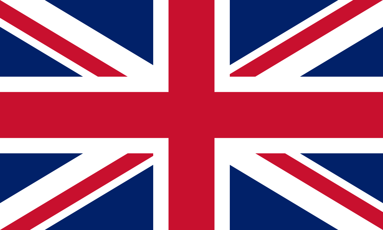
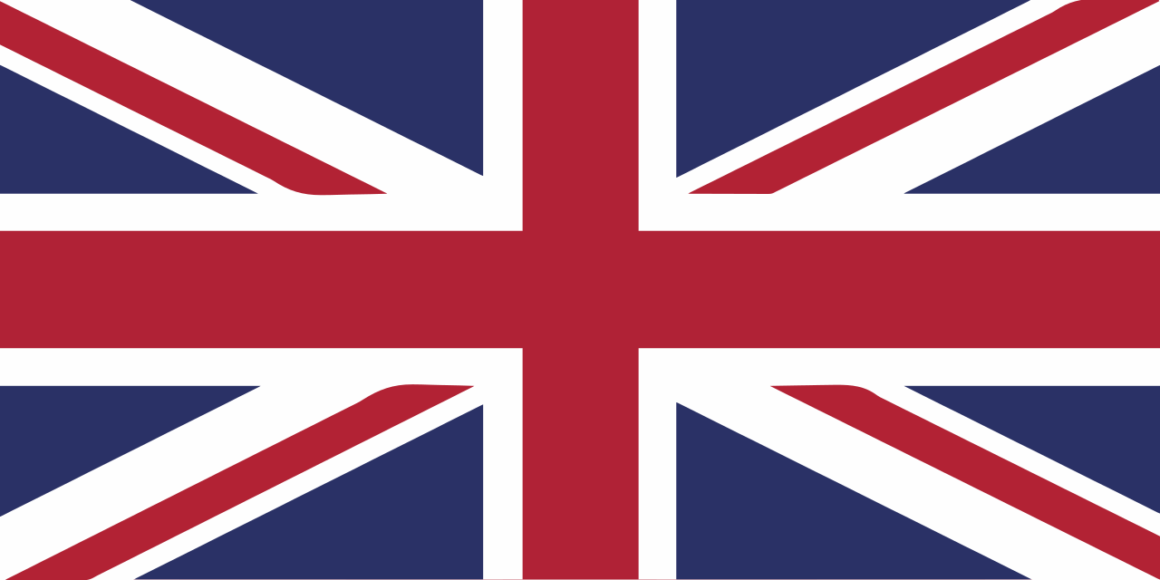
- The Union Jack is a heraldic puzzle: it fuses the crosses of St George (England), St Andrew (Scotland), and St Patrick (Ireland). Notably, Wales has no separate cross on the flag because at the time of its design, it was
- The British Isles are an archipelago of over 6,000 islands, yet only a few hundred are inhabited; the majority remain silent sentinels to history and nature.
- Unlike most nations, the UK has no single written constitution. Instead, its laws and governance rely on a complex tapestry of ancient statutes, common law precedents, and unwritten constitutional conventions that have e
- In the 19th century, British settlers introduced bumblebees to New Zealand specifically because local crops like clover needed them for pollination—a small insect with a massive agricultural legacy.
Origins and Etymology
The geographical term originates from 1595 when Gerardus Mercator released a volume titled "Atlas Sive Cosmographicae Meditationes de Fabrica Mundi et Fabricati Figura." Initially, this neologism described the creation and form of the entire universe rather than just mapping collections. Mercator chose this name to honor the Titan Atlas, whom he regarded as the first great geographer and King of Mauretania. Although published posthumously, the work evolved over subsequent editions into a simple compilation of maps by the mid-17th century. This shift solidified the modern definition we recognize today. Before Mercator, the concept existed but lacked this specific branding. The transition from cosmographical meditation to practical map collection marks a pivotal moment in cartographic history, establishing a standard for future publications that would eventually encompass everything from terrestrial regions to celestial spheres.
Historical Development and Production
While Italian cartographer Pietro Coppo prepared systematically arranged maps in the early 16th century, his work remained unpublished. Consequently, the title of the first modern atlas is conventionally awarded to Abraham Ortelius for his "Theatrum Orbis Terrarum," printed in 1570. Early production methods differed significantly from contemporary practices; most atlases were not bound books ready for immediate purchase. Instead, components were shelved separately, allowing clients to select specific contents and decide on coloring or gilding before binding occurred. This customization meant early editions with identical title pages could vary widely in content. By the 19th century, states began producing national atlases, standardizing the format further. Today, multimedia formats supplement traditional book forms, though the core function of presenting geographical features remains consistent across centuries of evolution.
Varieties and Functional Designs
Modern cartography categorizes atlases by their intended utility and subject matter. A travel atlas prioritizes portability, often featuring spiral bindings to allow the book to fold flat during journeys; these are sometimes synonymous with road maps. In contrast, a desk atlas functions as a reference library volume available in hardback or paperback. Scale precision varies significantly by type; European national atlases typically range from 1:250,000 to 1:500,000, while city atlases offer greater detail at 1:20,000 to 1:25,000, sometimes doubling for central areas like London. Beyond terrestrial geography, specialized volumes exist. Star atlases depict the celestial sphere and named asterisms, while planetary atlases map other Solar System bodies. Additionally, anatomy atlases apply cartographic principles to map human organs or organisms, demonstrating the versatility of the format beyond simple political boundaries.
Notable Editions and Legacy
Throughout history, specific publications have defined the medium commercially or cartographically. Abraham Ortelius's 1570 work stands alongside Gerardus Mercator’s 1595 volume as foundational texts. The 17th century saw significant contributions from Joan Blaeu with his "Atlas Novus" and "Atlas Maior," while John Ogilby’s "Britannia" became the first printed at a specific scale in 1675. Moving into the modern era, the Times Atlas of the World began publication in 1895, continuing to the present day alongside the Geographers' A–Z Street Atlas from 1938. International examples include the Rand McNally Atlas in the United States and the Andrees Allgemeiner Handatlas in Germany. These selected works illustrate a progression from hand-colored collections to standardized reference tools that continue to document geopolitical, social, and economic statistics for contemporary users worldwide.
Gallery