United States
A land of vast horizons, revolutionary spirit, and enduring democratic ideals.
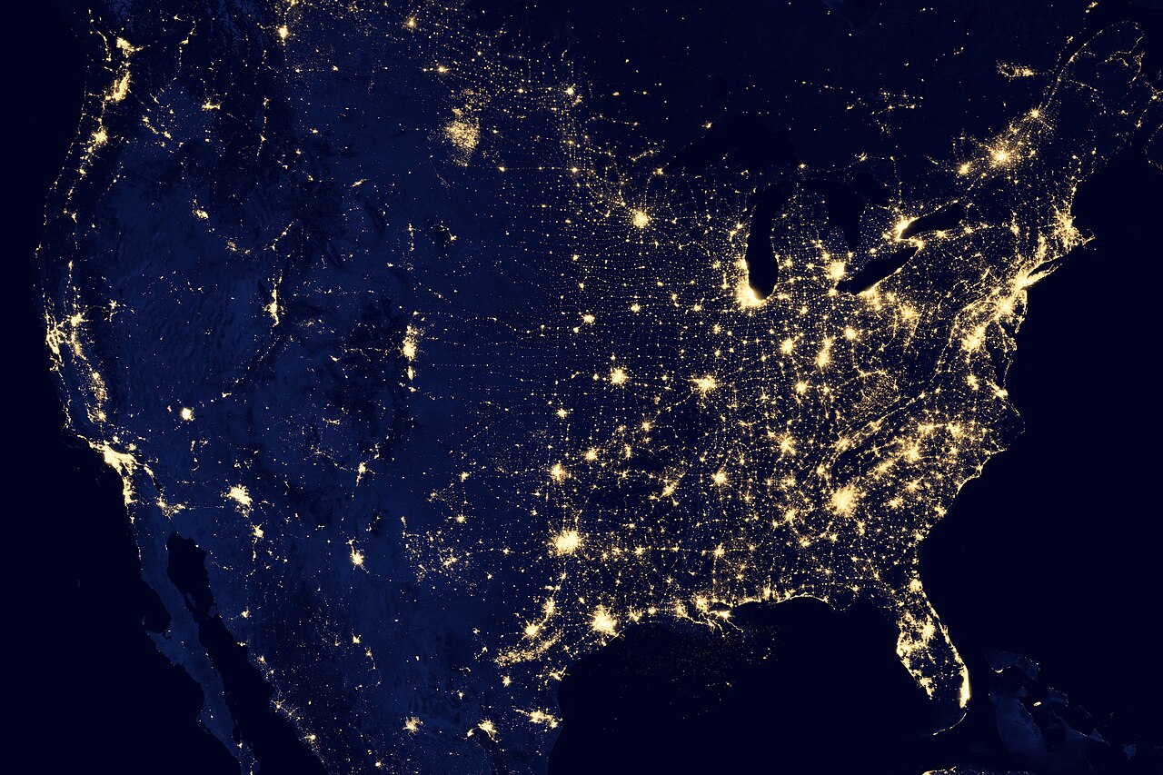
The United States of America is a federal republic spanning much of North America, renowned for its vast geographic diversity and profound global influence. From the Atlantic to the Pacific coasts, it serves as a cultural melting pot where fifty distinct states blend into a single national identity shaped by revolution, expansion, and innovation.
- Area
- 9,833,520 km²
Lore & Background
The nation's landscape ranges from Arctic tundra in Alaska to subtropical Everglades in Florida, encompassing towering mountain ranges, vast plains, and deep canyons. Culturally, it is defined by a dynamic mix of Indigenous roots, European immigration, African heritage, and Latin American influence, creating a unique tapestry of arts, cuisine, and social movements that continue to shape global trends.
In Their Own Story
The wind howled across the High Plains, carrying the sharp scent of sagebrush and an approaching storm. In the distance, Mount Rushmore carved its granite profile against a bruised purple twilight—not just a monument, but a silent witness to centuries of conflict, expansion, and reinvention. A lone traveler paused at the canyon's edge, staring into an abyss where history wasn't merely recorded in books but etched into the red rock and dust, feeling the sheer, vibrating weight of a nation that stretched from the icy Atlantic surf to the golden Pacific horizon.
Reader's Guide
The United States is a geographic titan, spanning six time zones with climates ranging from the tropical rainforests of Hawaii to the frozen tundra of Alaska. Its story begins with complex Indigenous civilizations thriving for millennia before European contact, followed by a revolution in 1776 that birthed a new republic and a westward expansion that redrew the map. The Civil War (1861–1865) remains the nation's defining crucible, ending chattel slavery while leaving deep, enduring social scars.
Culturally, the U.S. acts as a global laboratory of innovation, fusing immigrant traditions into a dynamic mosaic that dominates music, film, technology, and literature. Cities like New York, Los Angeles, and Chicago serve as pulsating engines of this diversity. Natural wonders such as the Grand Canyon, Yellowstone's geysers, and the Statue of Liberty stand as dual symbols: one of geological awe, the other of democratic aspiration.
Economically, it is a powerhouse fueled by a unique blend of high-tech finance, vast agricultural output, advanced manufacturing, and Silicon Valley ingenuity. This distinctive cocktail of rugged individualism, relentless entrepreneurship, and complex civic engagement continues to drive its central role in global politics, culture, and economics.
Did You Know?
- The U.S. has more than 3 million miles of roads, the most extensive highway system in the world.
- Alaska is larger than the next three largest states combined (Texas, California, and Montana).
- The national anthem, 'The Star-Spangled Banner,' was written during the War of 1812 by Francis Scott Key.
- There are over 400 national parks, monuments, and historic sites managed by the National Park Service.
Historical Foundations and Early Publications
The National Atlas of the United States originated in the late nineteenth century as a government publication designed to visualize census data and geographic information. The inaugural volume, released in 1874, was officially titled the Statistical Atlas of the United States Based on the Results of the Ninth Census 1870. Francis A. Walker served as the Superintendent for that census and compiled the work with assistance from various scientific experts and government departments. This early edition featured diverse cartography covering population distribution alongside economic indicators and natural resources such as coal, forests, and precious metals. Following this initial success, Henry Gannett, who held positions as Chief Geographer for both the Census Bureau and the U.S. Geological Survey, supervised the creation of three subsequent national atlases. His final contribution to this series was published in 1920, establishing a precedent for federal geographic documentation that would continue until the next major edition arrived fifty years later.
The Comprehensive 1970 Edition
A significant gap occurred between the early twentieth-century publications and the next major release, which arrived in 1970. The U.S. Geological Survey managed this project under Chief Geographer Dr. Arch C. Gerlach, requiring several years to complete production. This substantial physical volume weighed twelve pounds and contained four hundred pages featuring a collection of 765 distinct maps. These visuals aggregated scientific information from various Federal sources to depict the nation’s physical features, historical evolution, economic activities, and sociocultural conditions. The primary audience included government officials and researchers needing to visualize country-wide patterns regarding environmental phenomena and human activities. Approximately fifteen thousand copies were printed, but at a price of one hundred dollars—equivalent to over eight hundred dollars in modern currency—the atlas remained cost-prohibitive for most individual Americans. Consequently, the majority of these volumes were acquired by educational institutions and libraries rather than private citizens, ensuring access primarily through public or academic channels.
Digital Expansion and Public Domain Status
The final iteration of the National Atlas emerged in 1997 and marked a significant shift toward digital accessibility. While the U.S. Geological Survey led its creation, more than twenty federal agencies cooperated to produce this comprehensive resource. This edition introduced the first online interactive mapping program offered by the Federal government, providing thousands of printable maps and fully documented digital cartographic datasets. The platform complied with Open Geospatial Consortium standards and included multimedia dynamic maps alongside innovative applications. Because it was a publication of the United States government, all maps and data remained in the public domain within the country. Its stated purpose involved increasing geographic knowledge while fostering national self-awareness through a comprehensive view of geospatial data. Furthermore, information from this atlas supported continental-scale tools like the North American Environmental Atlas when combined with Canadian and Mexican data. This online version served as the primary access point for these resources until its eventual retirement was decided in late 2013.
Program Termination and Data Archiving
In late 2013, mapping managers at the U.S. Geological Survey made the decision to terminate the program, even though nationalatlas.gov received three times the usage of its counterpart service, nationalmap.gov. The official announcement regarding the demise occurred in February 2014, and the website was taken offline on October 1, 2014. Despite this closure, the data remains accessible through specific archival channels. Printable maps are archived via The Internet Archive's Wayback Machine, allowing downloads though previews are unavailable. Additionally, the U.S. Geological Survey maintains a subset of the information under its National Map Small Scale Collection, where some datasets have received updates since the Atlas retired. Users can also download datasets from EarthExplorer or access small-scale geologic data through the Mineral Resources Online Spatial Data site. Certain small-scale data containing National Atlas content is further available via the National Map Downloader or Staged Products, ensuring continued availability of this historical geographic information for researchers and the public.
Gallery